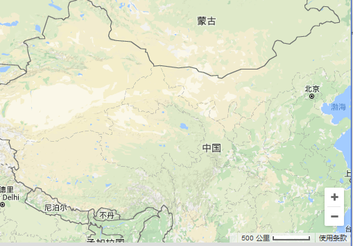
创建一个最简单的地图
代码如下:
<!DOCTYPE html>
<html>
<head>
<meta name="viewport"
content="width=device-width, initial-scale=1.0, minimum-scale=1.0, maximum-scale=1.0, user-scalable=no"/>
<meta http-equiv="content-type" content="text/html; charset=UTF-8"/>
<title>google</title>
<link rel="stylesheet" type="text/css" href="pub/css/console.css"/>
<script type="text/javascript" src="main.js"></script>
<script type="text/javascript" src="pub/js/maplabel-compiled.js"></script>
</head>
<body>
<div id="map_canvas" style="width: 100%"></div>
</body>
</html>
<script type="text/javascript">
var map;
//自定义地图
function BigeMap() {}
//地图下属瓦片大小
BigeMap.prototype.tileSize = new google.maps.Size(256, 256);
//地图最大级别
BigeMap.prototype.maxZoom = 19;
//地图最小级别
BigeMap.prototype.minZoom = 4;
//地图名称
BigeMap.prototype.name = "地图";
//此地图种类获取URL的地址
BigeMap.prototype.getTile = function (coord, zoom, ownerDocument) {
var img = ownerDocument.createElement("img");
img.style.width = this.tileSize.width + "px";
img.style.height = this.tileSize.height + "px";
//这里使用谷歌在线的数据,当然您也可以使用Bigemap地图下载器下载的离线瓦片作为此处的地址
var strURL = 'http://mt0.google.cn/vt/lyrs=m@365000000&hl=zh-CN&gl=cn&x=' + coord.x + '&y=' + coord.y + '&z=' + zoom + '&s=Galil';
img.src = strURL;
return img;
};
var google_map = new BigeMap();
var myOptions = {
//设置中心点
center: new google.maps.LatLng(30.54024807, 104.06966686),
//默认显示级别
zoom: 4,
//是否显示街景 因为大部分是离线,所以不需要显示
streetViewControl: false,
mapTypeControlOptions: {
mapTypeIds: ['google_online_map']
}
};
//初始化map对象
map = new google.maps.Map(document.getElementById("map_canvas"), myOptions);
//像map对象中添加一种地图
map.mapTypes.set('google', google_map);
//设置map对象默认显示 google 地图 也就是上面的google_map对象
map.setMapTypeId('google');
</script>
